ATC: Mountain Valley Pipeline an unprecedented threat to ALL national trails

Many small pipelines currently cross the Appalachian Trail, but they are nothing like the proposed new Mountain Valley Pipeline that would be built by a consortium led by EQT, a fracking company based in Pittsburgh, Pennsylvania. The latest edition of AT Journeys, the magazine of the Appalachian Trail Conservancy, has a major article on the threat of this pipeline to all national trails. “Cutting to the Core:Setting a Precedent for Pipeline Proposals” by Jack Igelman. (if you have trouble getting this link to open properly, please right click, copy the link, and paste into a new tab)

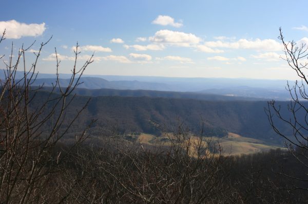
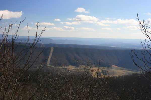
Unlike existing pipelines, this one would be visible off and on for almost 100 miles of the Appalachian Trail in Virginia. In Giles County, the pipeline would cut an ugly swath that would be visible from Kelly Knob on the AT, only about 2 miles away. Even worse, the project would create a 500-foot utility corridor through the national forest that would invite co-location of two or three equally large projects immediately adjacent to this monster.
Gary Werner, executive director of the Partnership for the National Trails System based in Madison, Wisconsin, says the project would set a precedent for lowering the status of all national trails, including the Pacific Crest Trail and many others. Construction of the Mountain Valley Pipeline would ignore established scenic standards that required decades of work and massive financial expenditures by citizens, nonprofits, the US Congress and government agencies.
Yet the applicant contends that the project would have almost no impact on scenic values, public safety or the water supplies to both groundwater wells and public drinking water for Roanoke, Virginia and a host of other places. Andrew Downs, ATC’s Regional Director in Virginia, expresses frustration at the extremely poor quality of the pipeline’s documentation, noting that, “It’s almost comical. The document is missing huge and important pieces of analysis.” Diana Christopulos, President of the Roanoke Appalachian Trail Club, was unconcerned about yet another pipeline until she learned the facts about this one. Now she describes is as “a total trainwreck.” Here are some of the reasons:
- The Mountain Valley Pipeline would measure 42 inches in diameter, more than twice the size of the large transmission pipelines that currently supply the East Coast. It would be under 1,440 pounds of pressure per square inch, with a blast zone (where everything is destroyed) of about 1,000 feet on each side (based on recent explosions of large pipelines, the distance might be closer to 1,600 feet) and an evacuation zone (where anyone present would suffer serious injuries) of about 3,600 feet on each side.
- Instead of following roads, railroads and rivers like existing transmission pipelines, it would climb steeply up and down almost 225 miles of slopes with significant landslide potential, including 120.0 miles of extremely steep slopes (grades >20%)
- Over its 300-mile length, it would cut through almost 250 miles of forested land (over 80% of the total route), including an Old Growth Forest in Jefferson National Forest. It would pass directly through the Brush Mountain Inventoried Roadless Area, which has been declared eligible for Wilderness status, and directly next to both the Peters Mountain Wilderness and the Brush Mountain Wilderness.
Oh, and the pipeline would tunnel through the epicenter of the Giles County Seismic Zone, scene of the largest earthquake in recorded Virginia history, with an estimated magnitude of 5.9. What could possibly go wrong?
